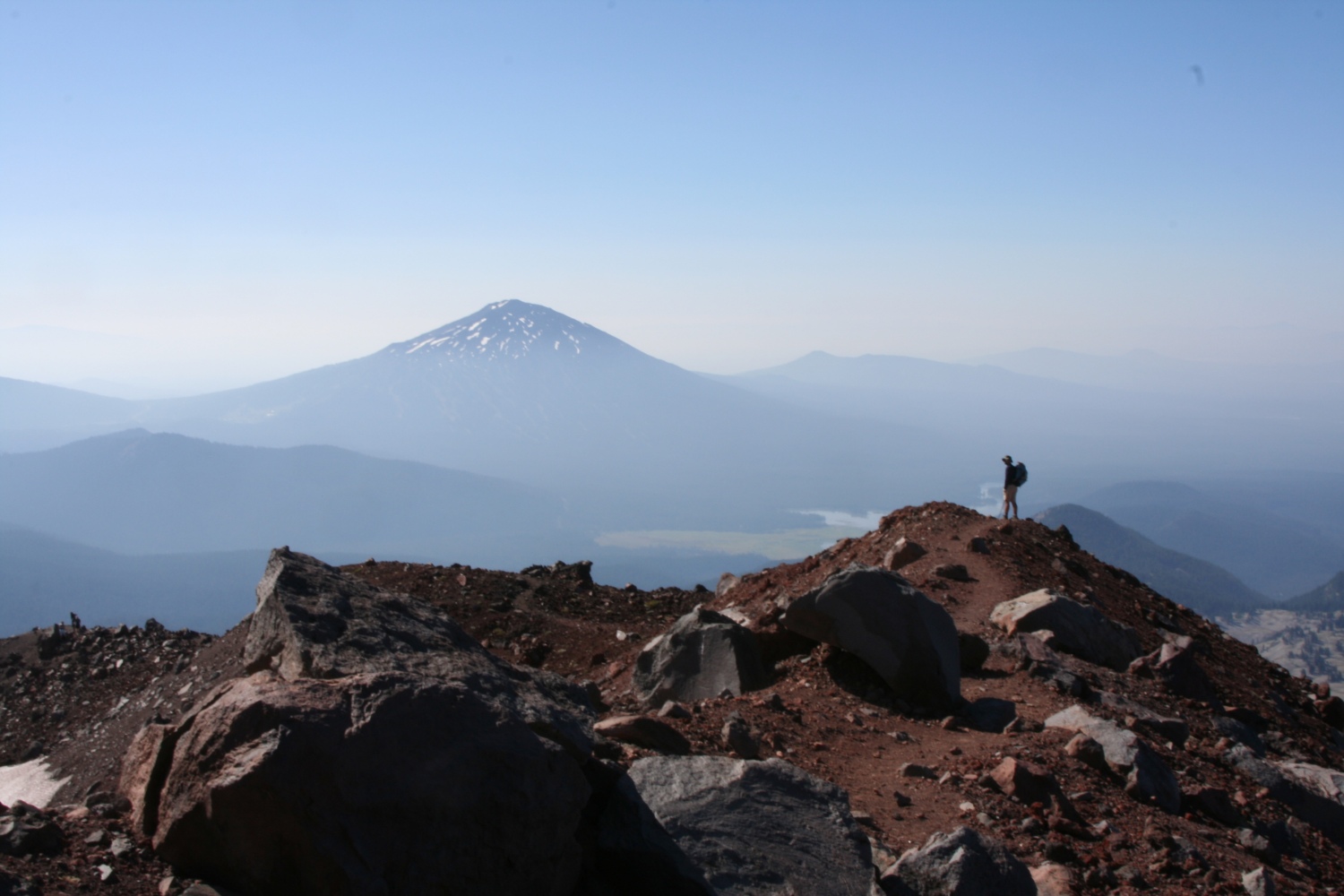
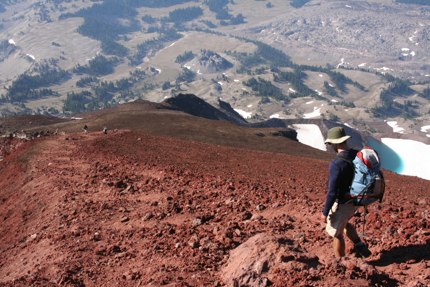
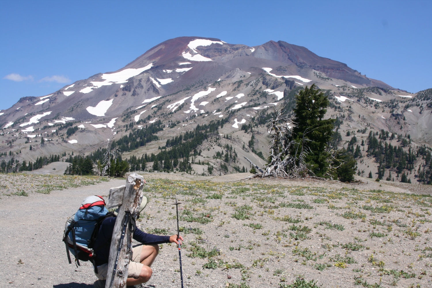
South Sister
The original plan had called for a three-day expedition to Glacier Peak (it's a long approach). The flaw in this plan was that our planned route involved a full day of glacier travel, and neither Greg nor I had significant glacier experience. So doing it as a two-man team was out of the question, for safety reasons. (Crevasse rescue is much easier with three men sharing a rope.) At one point it looked like we'd have two three-man teams; as of the Tuesday before my flight we still had a three-man team and I scurried to buy pulleys and prussiks, and borrow pickets, but in the end we had only two of us and we had to pick an alternate destination.
It wasn't until we'd been on the road for a couple of hours that it dawned on me that South Sister is a LONG drive from Seattle. No matter, I got to see some scenery (when I wasn't napping): from forests of giant evergreens, to almost-flat plains, to mountains, to the scars of huge forest fires, to dry, sagebrush-studded scrub. The ongoing heat wave was much in evidence; at one point somebody had set up an irrigation system to keep a stand of aspen alive. You know the old cliche about "it's a dry heat"? Turns out there's some truth to it. Ninety-five (35C) in eastern Oregon feels similar to 85 (29C) in Boston: hot, but bearable.
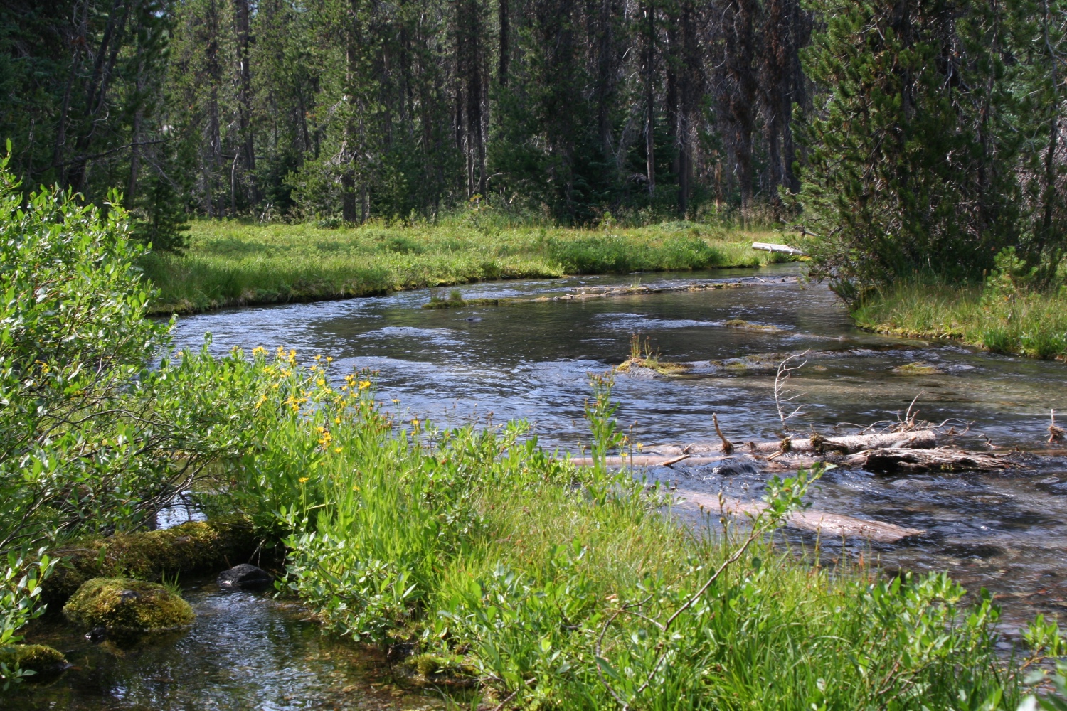
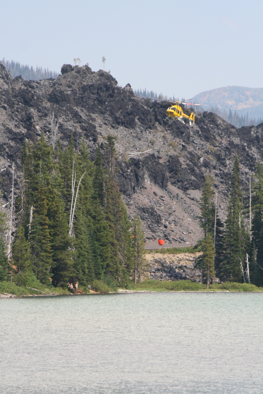
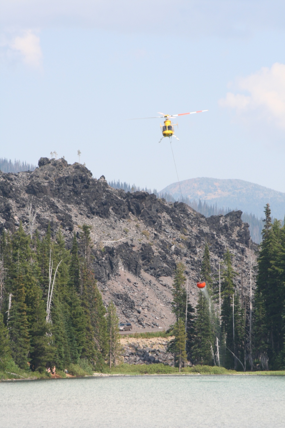
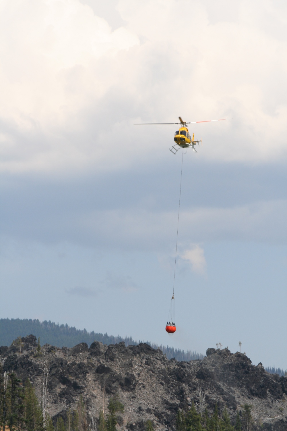
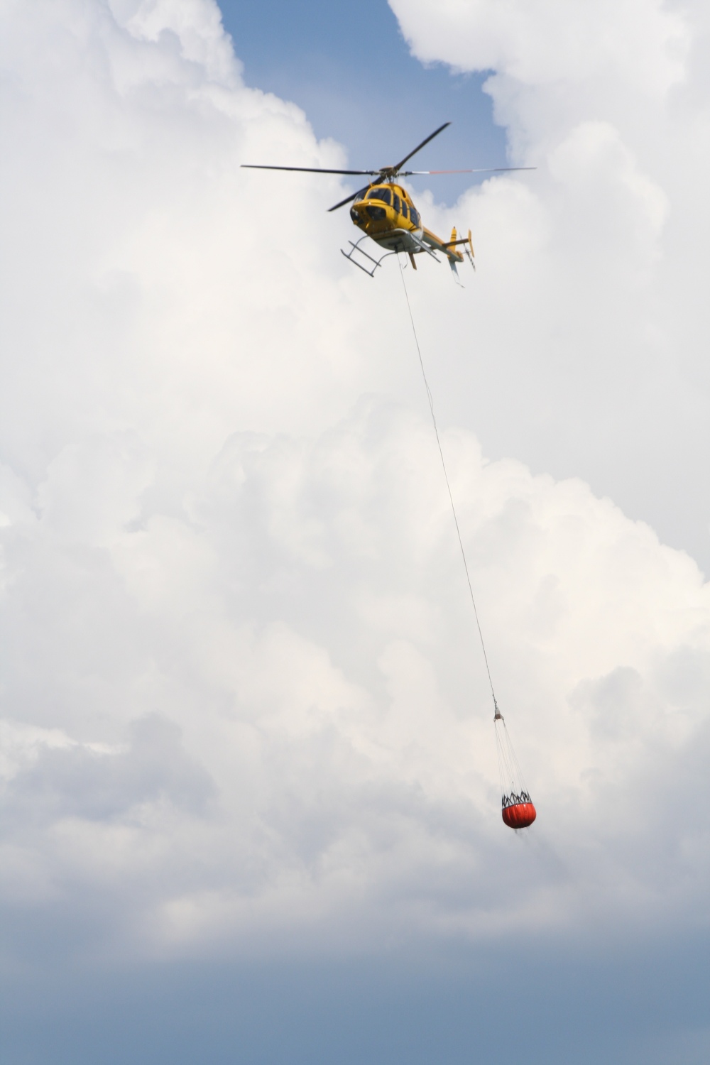
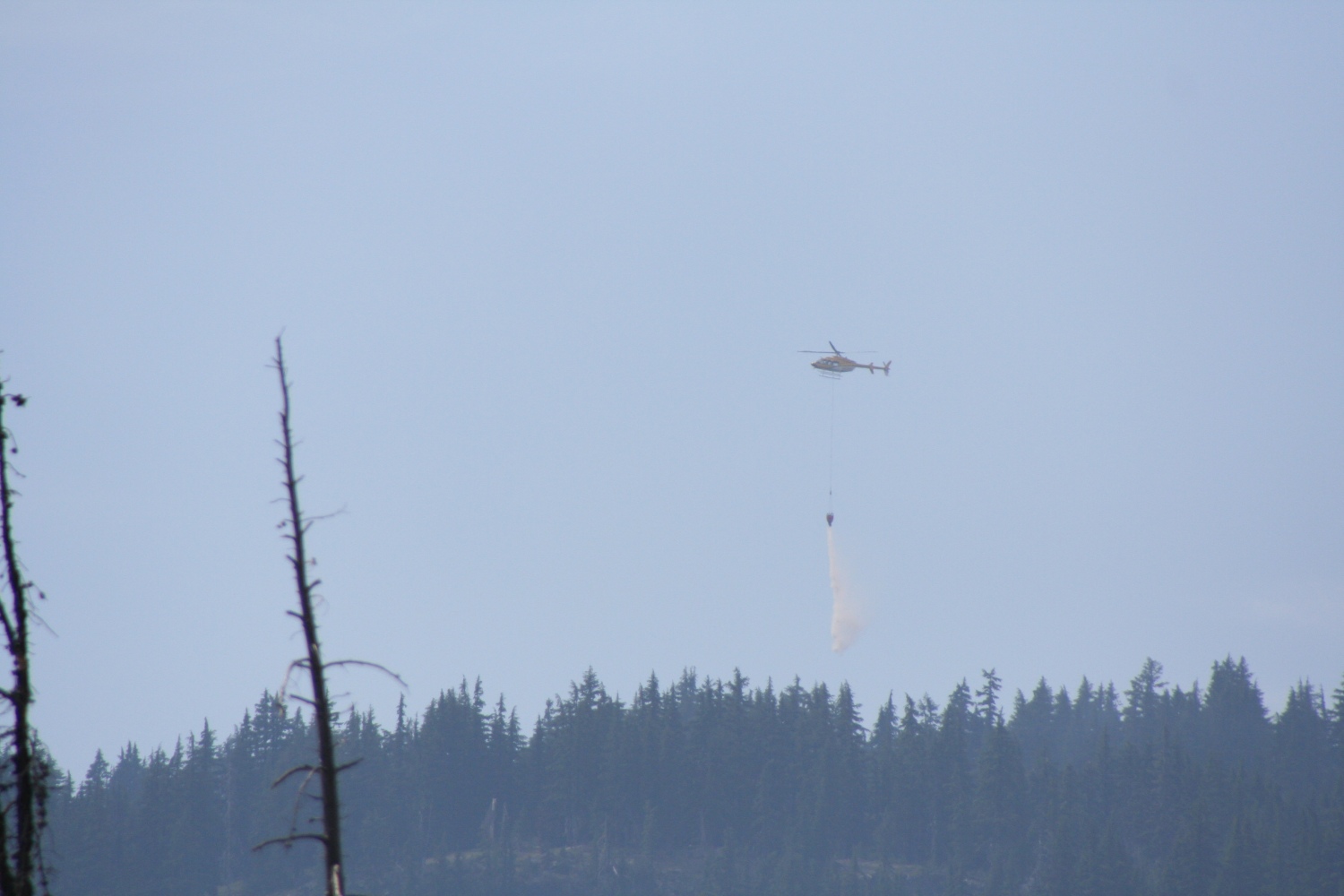
Sometime in the afternoon we reached Devil's Lake and picked a camping site in a lava field beside a numbingly cold stream. Greg was eager for an alpine start at midnight to be on the summit before sunrise. I hate alpine starts, but the daytime heat convinced me, though I still haggled out an extra two hours of sleep. So once the tent was set up, we wasted little time in hitting the sack, pausing only for dinner and to watch a helicopter picking up water in the lake to dump on a nearby forest fire. Greg has a remarkable ability to fall asleep anywhere and was soon out cold; I lay awake listening to birds for a while but, thanks to earplugs and some chemical aid, fell asleep within an hour or so.
|
A numbingly cold stream beside our campsite. |

|
A firefighting helicopter prepares to fill its bucket. |
|
Almost down... |
|
Lifting off with a full bucket. |
|
Heading right towards us. |
|
Helicopter passing overhead. |
|
Dropping water on a nearby fire. |
When our alarms woke us at 2AM I was surprised to feel - not rested, but not miserable. Except for refilling our water bottles (we'd each consumed about a liter during the night), all our stuff was ready to go. We just put on our headlamps, picked up our packs, and hit the trail.
When refilling my water at the stream I'd thought I'd heard a noise upstream, and now when the trail passed that spot our headlamps reflected a pair of green eyes about a foot above ground level. As I approached, the eyes suddenly lifted to about six feet high, and then we were able to discern the outline of a deer. I tried to get a photo, but it was hopeless. (Partly due to lack of light, partly due to my mental state at 2 AM. I'd left the shutter in timer mode, and didn't notice.)
Hiking in the dark is always disorienting, and I couldn't make much sense of the trail's wanderings as it drifted around in the valley between Devil's Hill and Kaleetan Butte, but at least there was no risk of losing this trail. Once on the ash plateau north of Devil's Hill, and mostly out of the trees, we used only one headlamp at a time.
reeline in the East is mostly determined by wind: above a certain elevation, trees abruptly get shorter as they huddle in each other's "wind shadow", and soon cease altogether. The whole transition from impenetrable forest through tangled "cripplebush" to alpine tundra usually takes less than a hundred feet of elevation. Out West, "treeline" is a nonsense word. Tree growth is mostly determined by water. Trees are never dense to begin with, and they just gradually get sparser. Even two thousand feet above the forest, all it takes is one little stream and trees can reappear. This is immensely frustrating to Easterners, accustomed as we are to charting our upward progress by the type and height of trees we pass. Those were the thoughts on my mind as we slogged northward toward a shadow above the horizon that we knew was South Sister.
Soon we could distinguish paler spots that had to be snowfields, and then we spotted a light - no two, three, maybe four. Somebody else was climbing the mountain at night, and had gotten a big head start. It looked like at least two parties, one of which might be climbing Lewis glacier. From this distance, they didn't seem to be moving very fast.
Eventually we were off the gigantic ash apron and heading uphill over scree and small rubble. At this point we could no longer see the lights above us - the flanks of the mountain hid them. In the dark we nearly wandered off-trail once or twice when footprints diverged to avoid minor obstacles in the form of small snowfields or slab/scree scrambles. Having been hiking for nearly two hours, I insisted on a break for snacks and water. This was a significant role reversal from a hike we'd once done in New Hampshire, when Greg (fifty pounds heavier at the time) had struggled to meet "book time" while I champed to go faster. This time I was the one calling for a slower pace. "Feeling strong?", Greg asked me while I sucked on a Gu he'd given me. "Definitely not strong", I replied. "But I'm OK considering it's four in the morning." The jolt of sugar from the Gu made a big difference, and we resumed our previous pace.
Around 6 AM we could see signs of dawn. We were up beside Lewis glacier now, slogging up a 45-degree slope of loose pumice in noticeably thinner air. The summit was in sight, and we had a chance of making it by daylight, but I was running low on energy again, and starting to feel signs of cramping in my legs. I called another halt and ate some salted peanuts. I urged Greg to go ahead and bag the sunrise from the top, but he chose to stay with me, saying what he really wanted to see was the shadow of the mountain spreading over the landscape below, and we were on the right side of the peak for that. Greg started telling me about pressure breathing, the rest step, other stuff I already knew. No need for any of that, I just had to keep my pace a bit slower than I'd have liked.
|
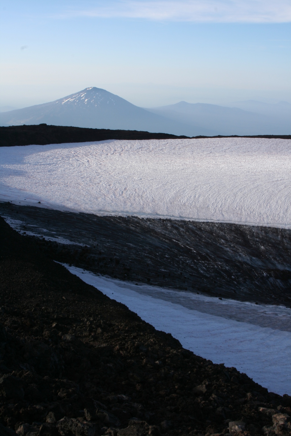
Around 6 AM, dawn breaks on the other side of South Sister, illuminating Broken Top and Lewis Glacier. |
If you step off-trail you can find your feet rolling downhill on a layer of small pumice stones. It's possible to run uphill faster than the pumice can roll down, but this is not a good idea when you're not acclimated to the altitude.
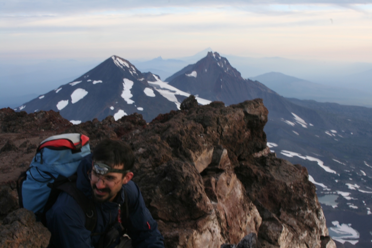
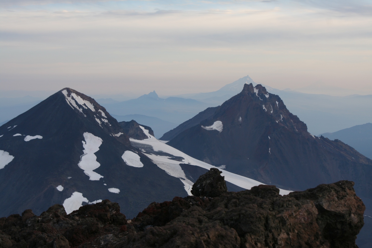
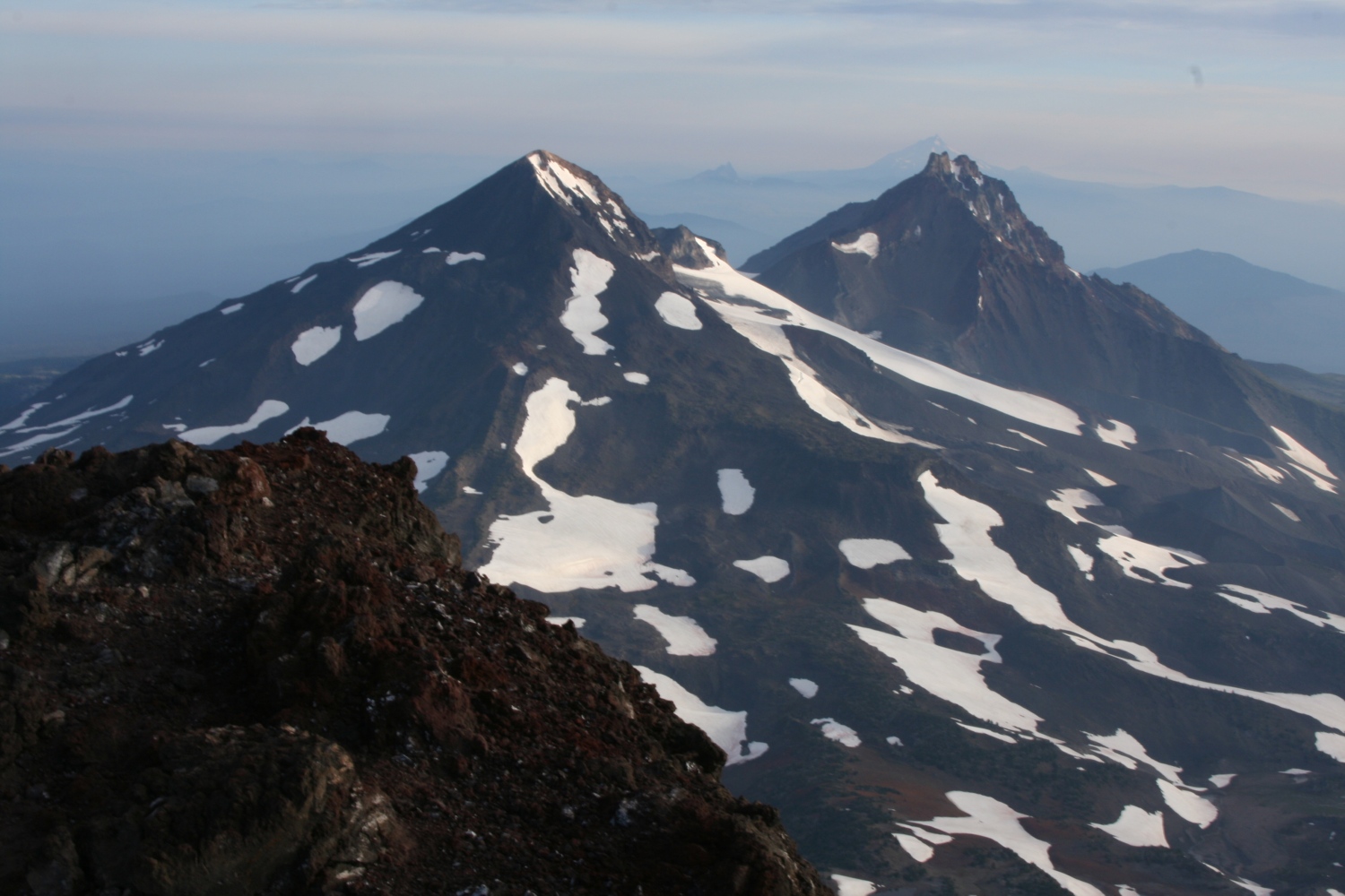
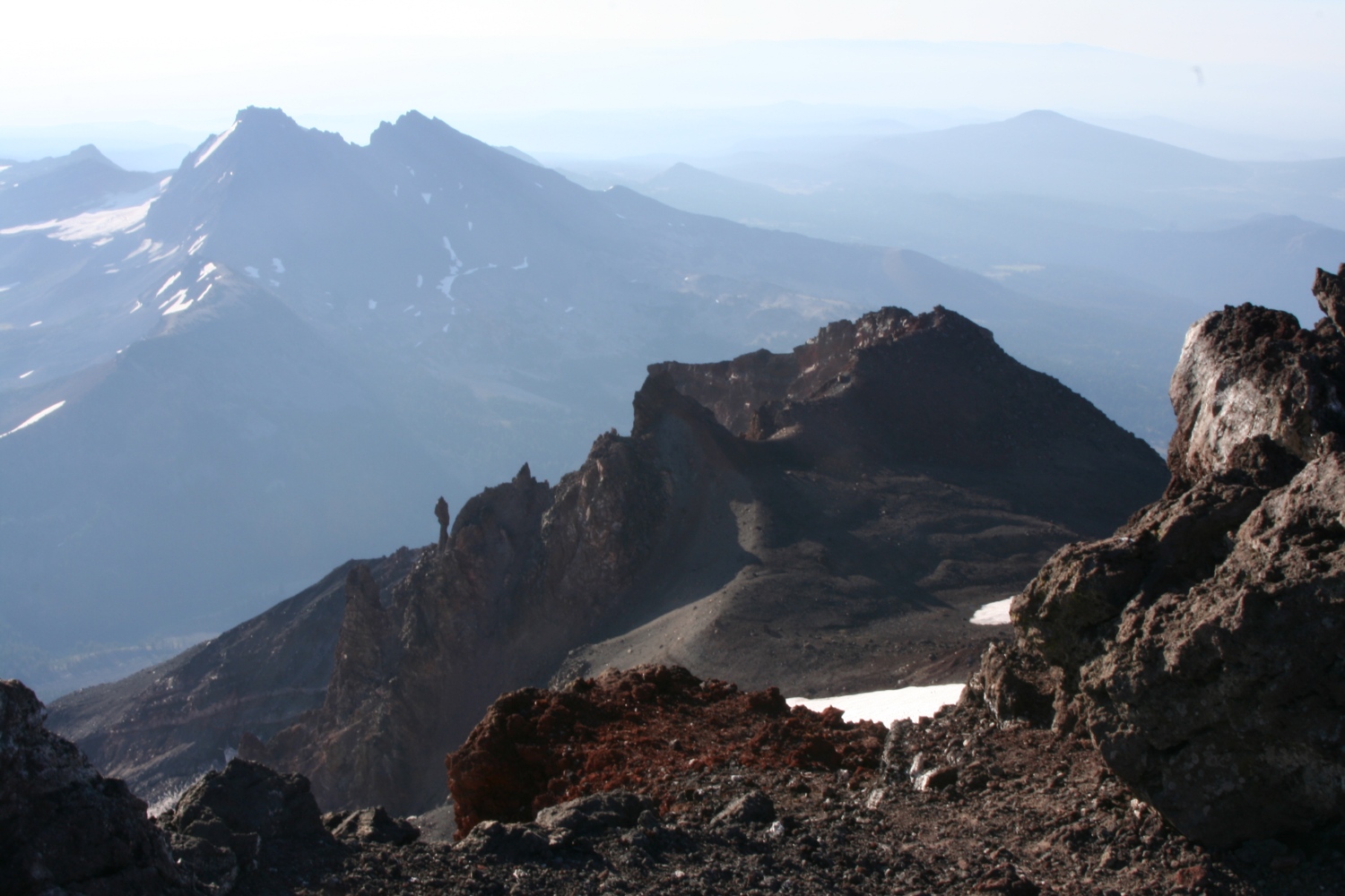
So it was a bit after dawn when we reached the crater rim. The climbers whose lights we'd seen (there were six of them) started passing us here on their way down, as we circled around the crater to the true summit. Four and a half hours up - not too horrible. And the views were great. Middle and North sister almost perfectly aligned in front of us, with other big volcanoes barely visible in the distance beyond them. Broken Top looking almost small (but by no means easy) beneath us. And smaller cindercones everywhere we looked, growing from a landscape of pumice slopes, flattened ash pillows, and black and broken lava fields.
|
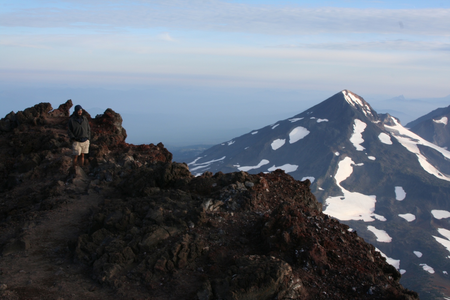
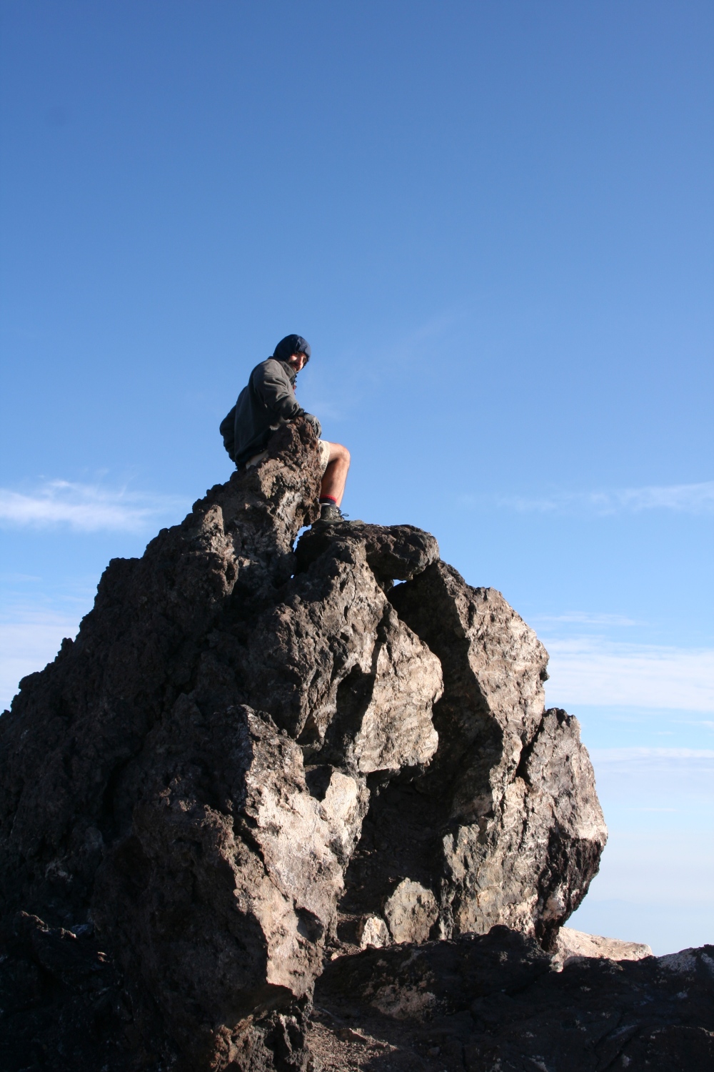
Greg on the summit, with Middle Sister and North Sister behind him. |
|
The other two Sisters. |
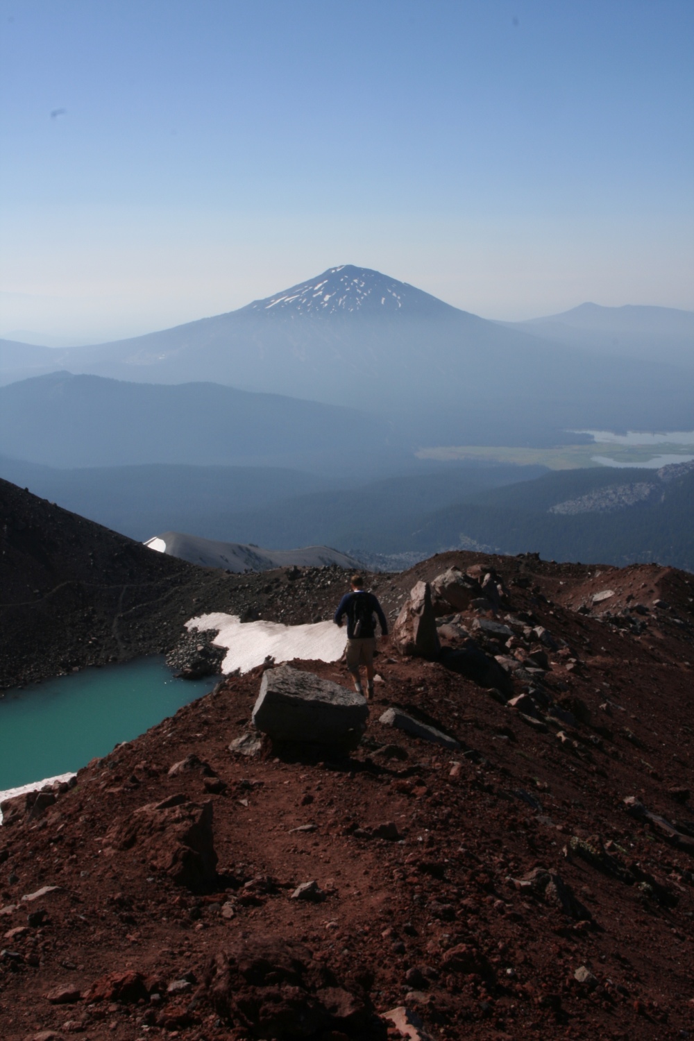
Greg had mentioned that if we did both South Sister and Middle Sister, the total was something like twenty miles and 10,000 feet of gain. That sounded feasible in a day, though we weren't planning to do it that way. So I was curious about the route from South Sister to Middle Sister.
First lesson: a 3,000-foot col may be entirely feasible, but it looks HUGE in person. Eastern cols are more like 500 feet or less. A long hike involves maybe ten of them in a day, so the total elevation lost and regained is the same, but there's something about actually seeing 3,000 feet of continuous descent that makes me less than anxious to get started.
Second lesson: the terrain here is different. I couldn't "read" it at all - cliffs just appeared in places I didn't expect; rock quality changed suddenly without rhyme or reason. I didn't see a way down that I could be really confident would "go" without a rope - and given the rotten rock, a rope might not be much help. Probably there is one (on a map the ridge heading north-northwest looks like the obvious choice, rather than hunting for a route down the north-northeast face like I was trying to do), but I wasn't prepared to make the attempt and risk backtracking all day.
|
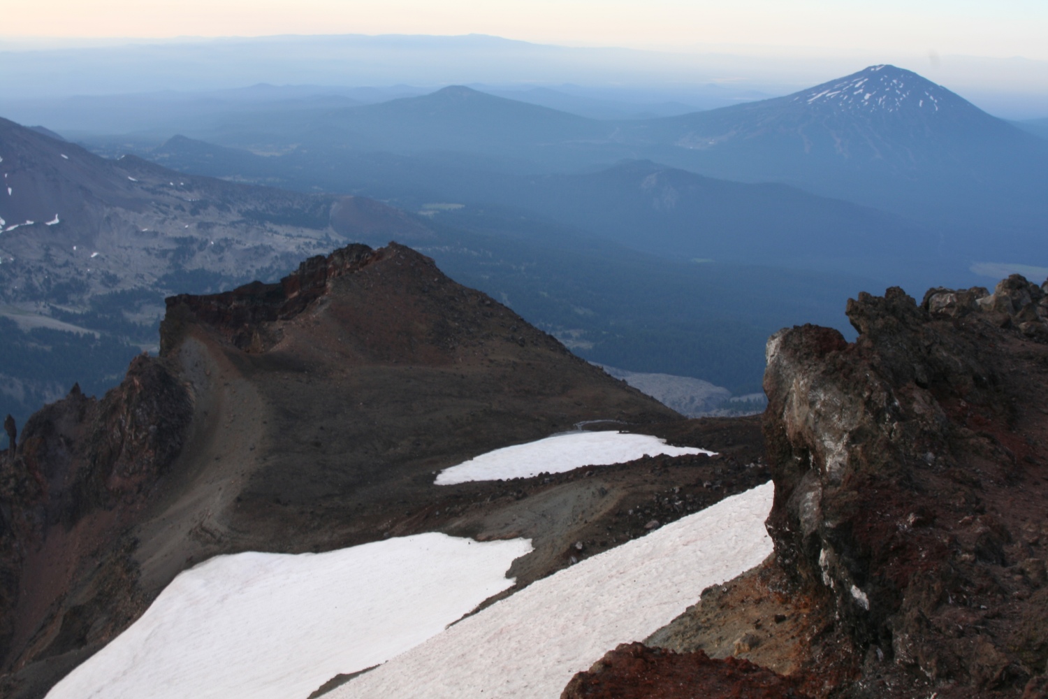
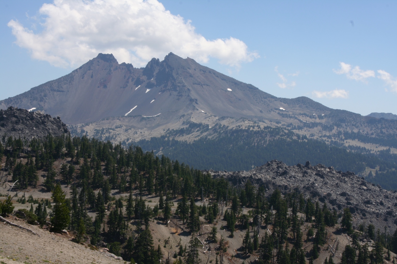
A view over Hodge's Crest. Mt Bachelor at right, Broken top just out of view to the left. |
|
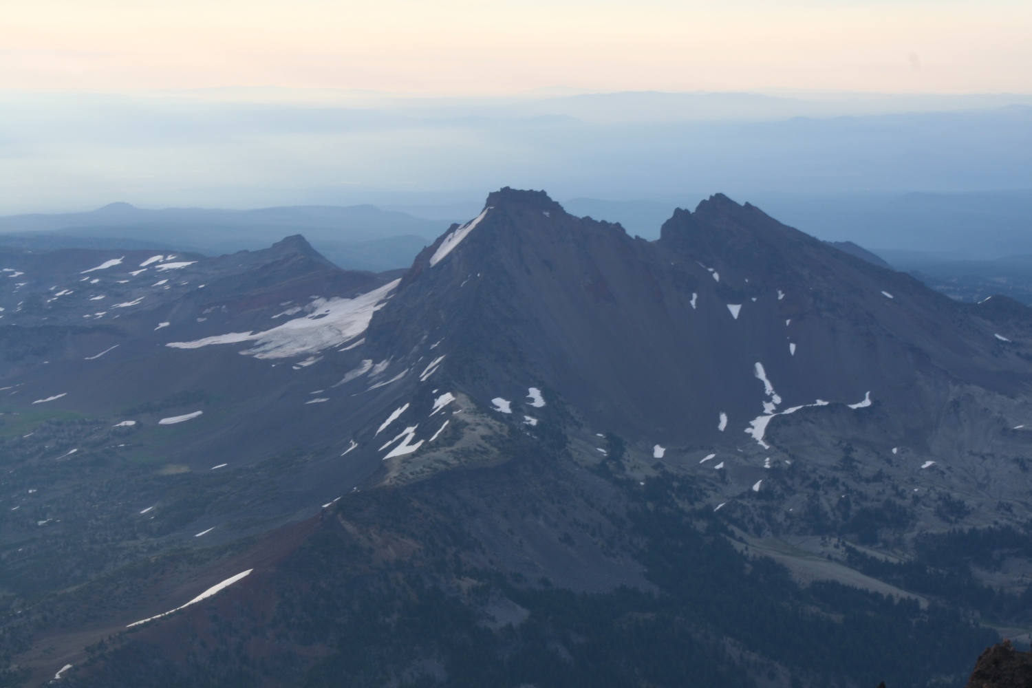
Another view of Broken Top. |
|
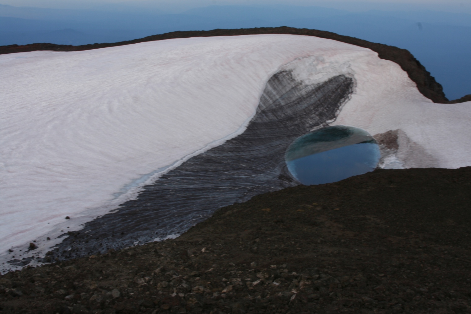
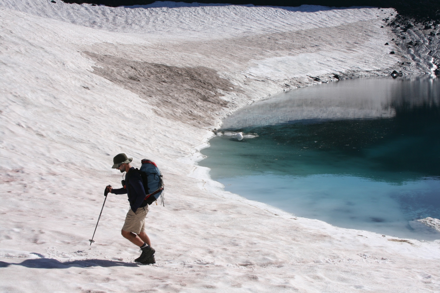
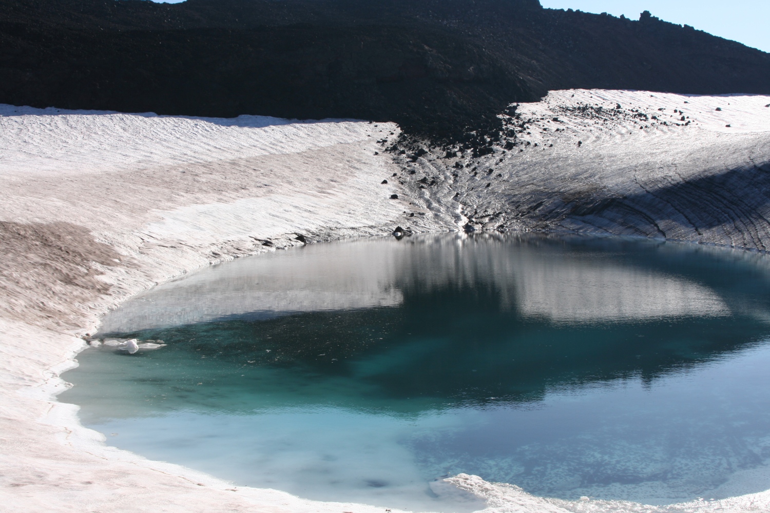
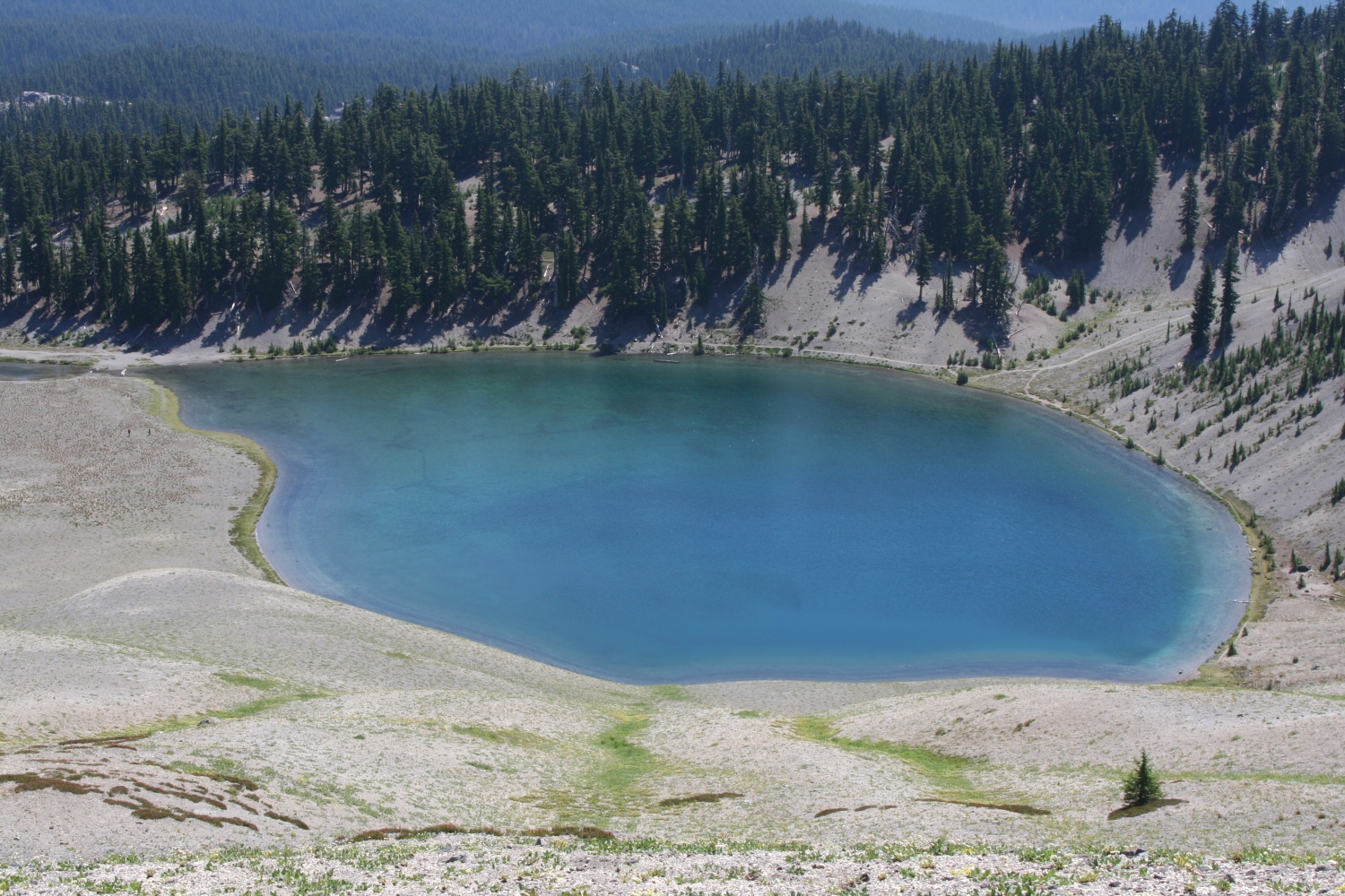
Teardrop Lake, inside the summit crater. |
|
Can't get enough of that view to the other Sisters. |
|
Greg admiring the view. |
|
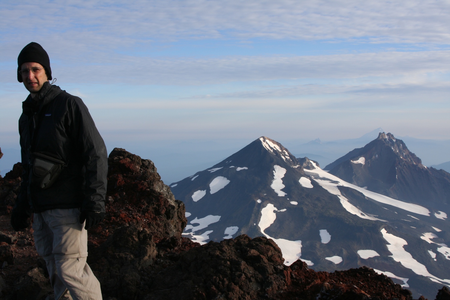
Yours truly, posing on the summit. |

|
Shadow of the volcano. |

|
One more view of the other Sisters. |
|
View across the crater toward Mt Bachelor. |

|
Teardrop lake. |
|
Hodge's Crest, with Broken top in the background. |
|
Greg on the exact summit. |
|
Flowers on the crater rim. |
|
Greg on the shore of Teardrop Lake. |
|
Greg walking away from Teardrop Lake. |
|
Teardrop Lake. |
|
Greg hiking back up toward the crater rim. |
|
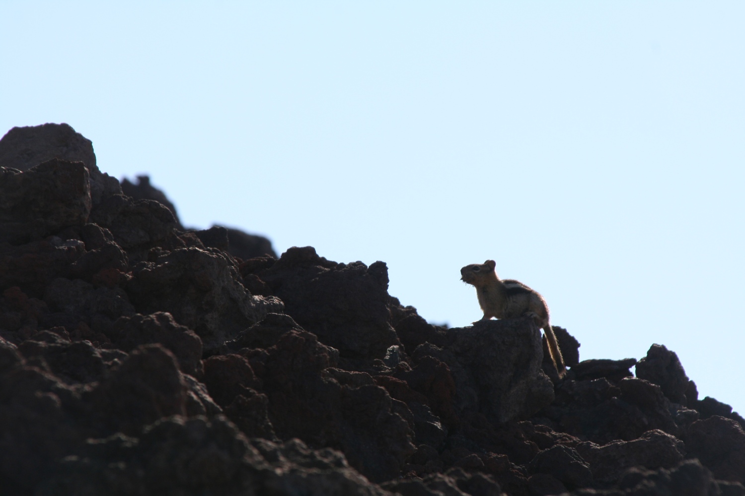
A golden-mantled ground squirrel on the crater rim. |
After lazing on the summit for about an hour and completing our circumnavigation of the crater rim (with a detour to the shores of Teardrop Lake) it was time to head down.
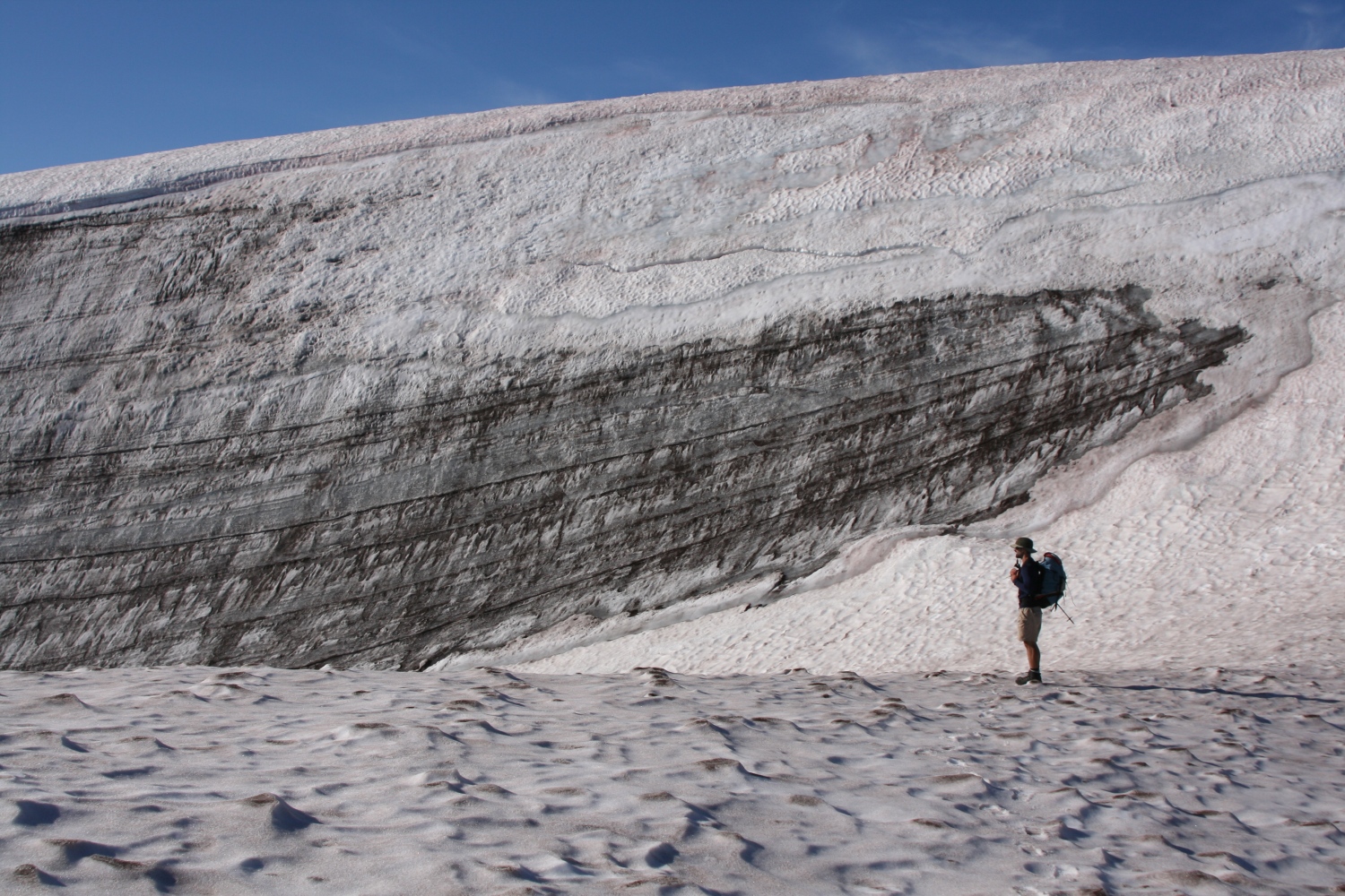
For the first time I could see the entire distance we'd climbed during the night. The summit cone was a brick-red heap that seemed to be composed entirely of loose pumice. This cone was mostly bare of snow, except for Lewis and Clark glaciers, which weren't much more than snowfields - Lewis had a significant bergschrund and a bit of a moat, but I didn't see any crevasses. Below the tarn at the foot of Lewis, the landscape turned grey, first rock and scree and then vast almost-flat plains of dusty ash leading down to the lakes.
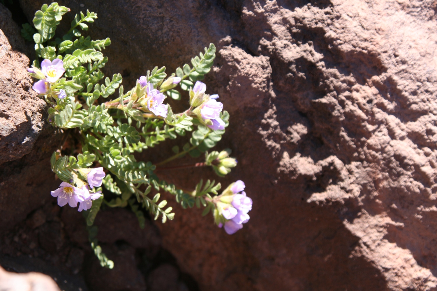
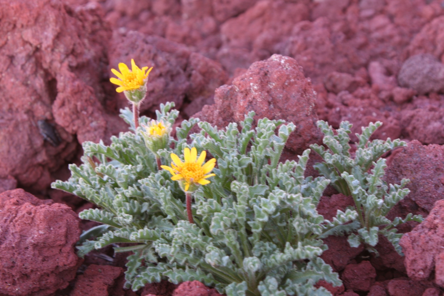
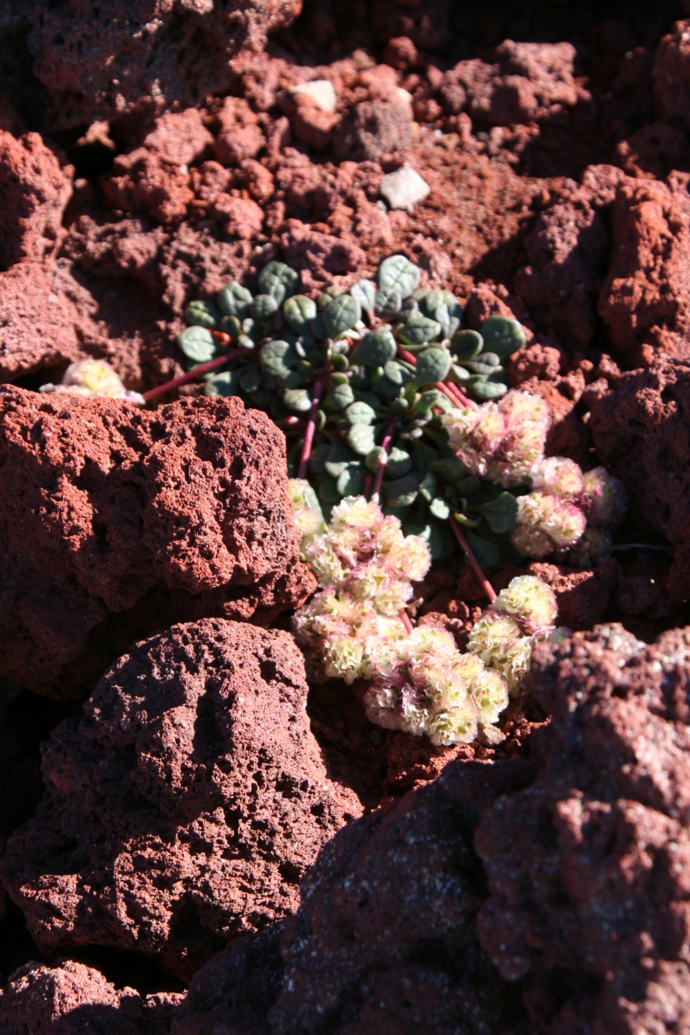
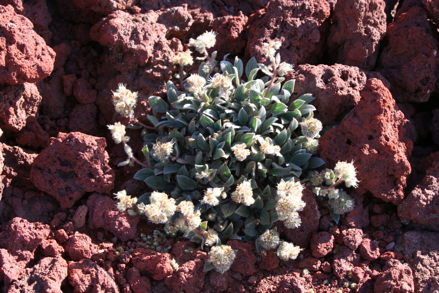
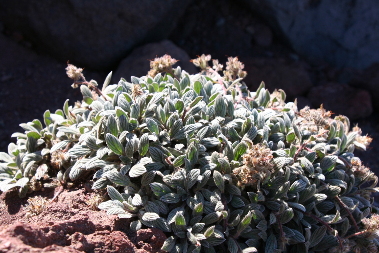
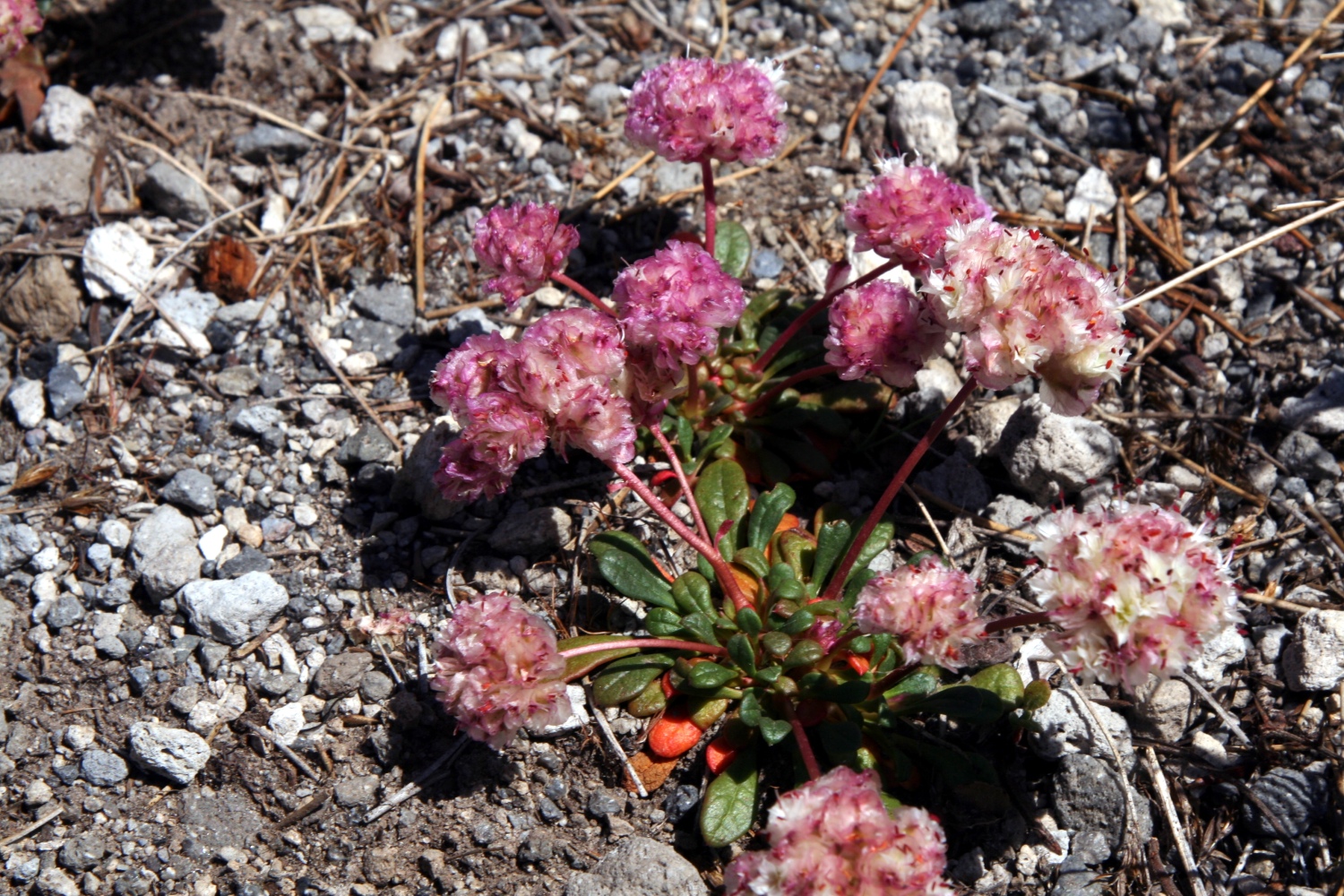
The pumice at the top looked completely dry, but a few plants proved that some moisture exists. Photographing these plants was not always easy, since my steps could unbalance the slope, uprooting all the life for yards around.
|
Dwarf alpinegold (Hulsea nana) near the top of the mountain. |

|
A succulent growing in a crack between pumice stones. |
|
I think this is a buckwheat. |
|
This is a phacelia. |
|
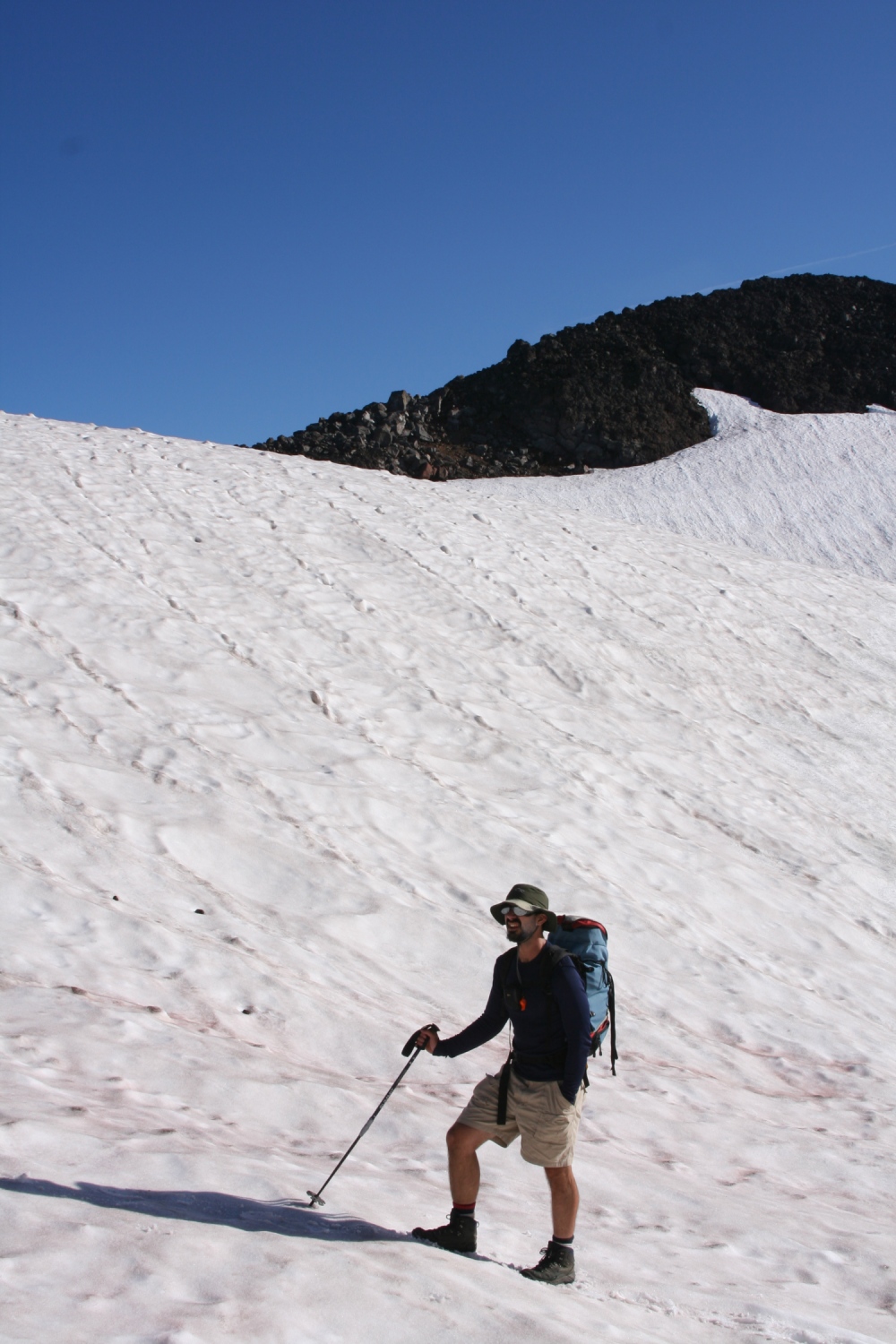
Greg beginning the long descent. |
Low on the summit cone, large basalt boulders were mixed in with the pumice, seemingly at random. The difference between pumice and basalt is amazing: pumice weighs vastly less than any other type of rock. So though it provides an excellent texture for gripping, and is not particularly fragile, you have to be extremely careful when clambering over pumice: blocks that look big enough to support an army will tip and roll under your weight. Basalt requires equal caution, but for opposite reasons: immovably heavy, it is smooth to the point of slipperiness and sometimes hides fracture lines that result in chunks breaking loose unpredictably. Here on the volcano, for the first time, I was seeing intermediate forms: boulders that were solid and smooth at one end but foamy at the other.
|
Mt bachelor on the horizon, Lewis terminal moraine and tarn in the foreground. |
|
Another phacelia. |
|
|
Greg on the moraine; Mt Bachelor in the distance. |
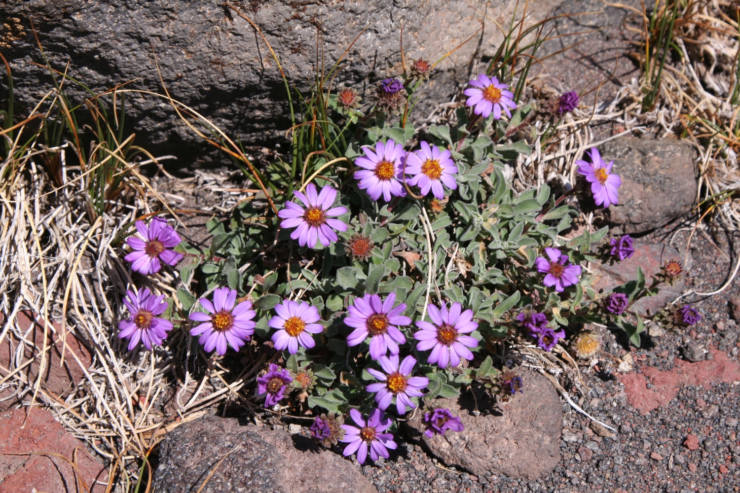
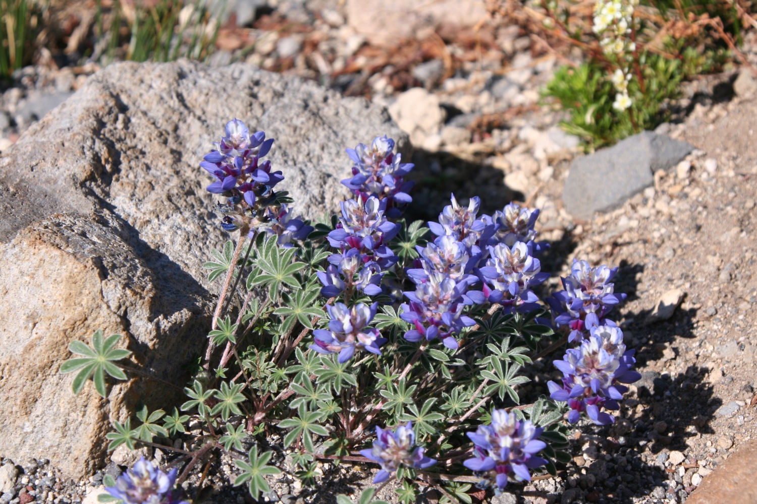
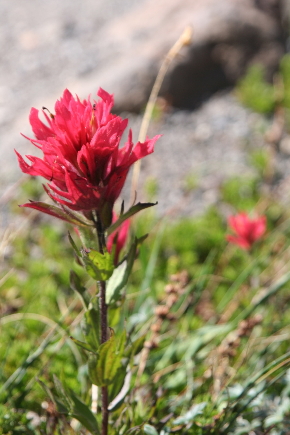
Below the cone the rock changed color to a light grey, like limestone, and additional wildflowers like indian paintbrush and lupine began to appear. The trail was mostly scree now, with one slabby section we recognized from having momentarily lost the trail on the way up. Below this, small stands of trees began, and then the landscape changed again to a nearly flat plain of old ash. Off to the side we could see jagged lava flows, with the volcanos looming high above them. At one point there was Moraine Lake, glittering emerald below us.
|
Townsendia sp. on the lower slopes. |
|
Unknown flowers. |
|
Lupines. |
|
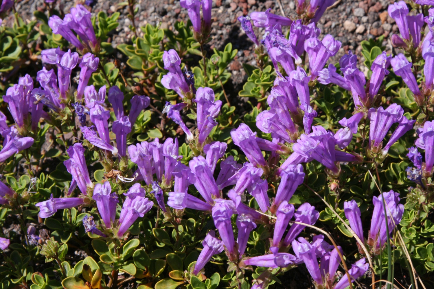
Indian paintbrush (Castilleja sp.) |
|
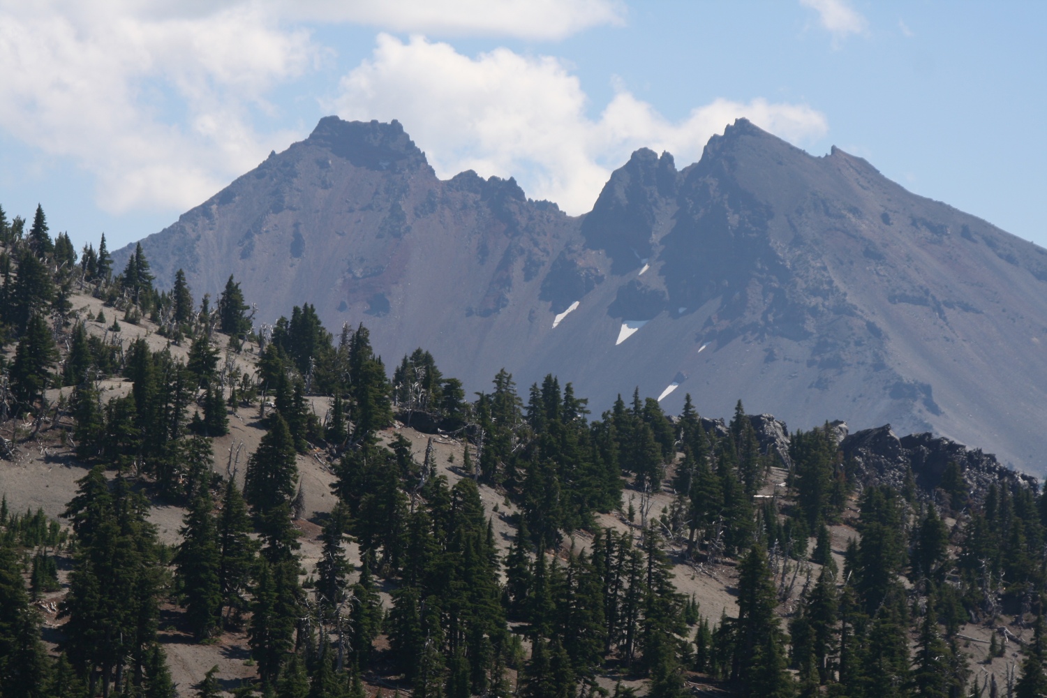
Broken top behind a buttress of sparse, dry woods. |
|
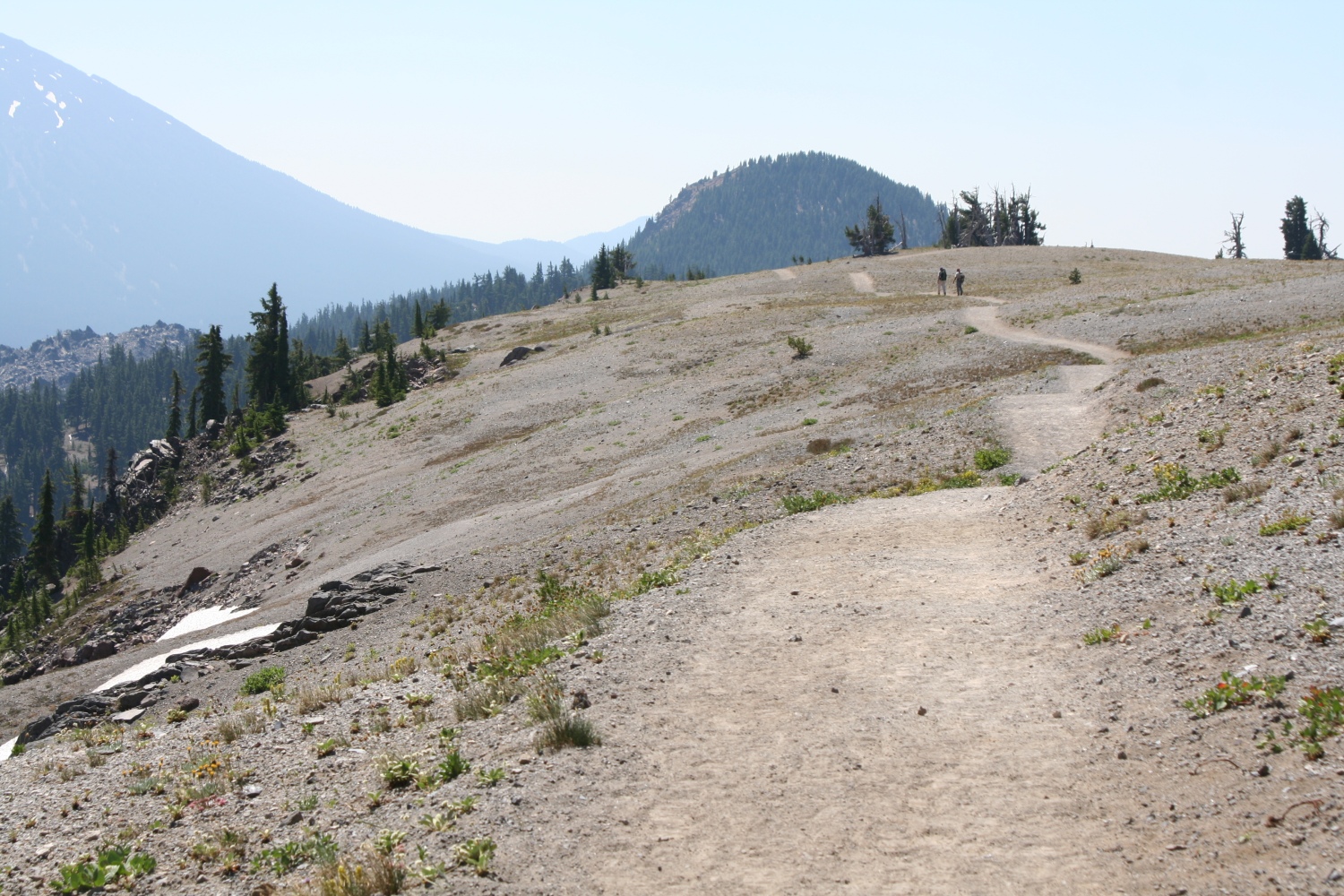
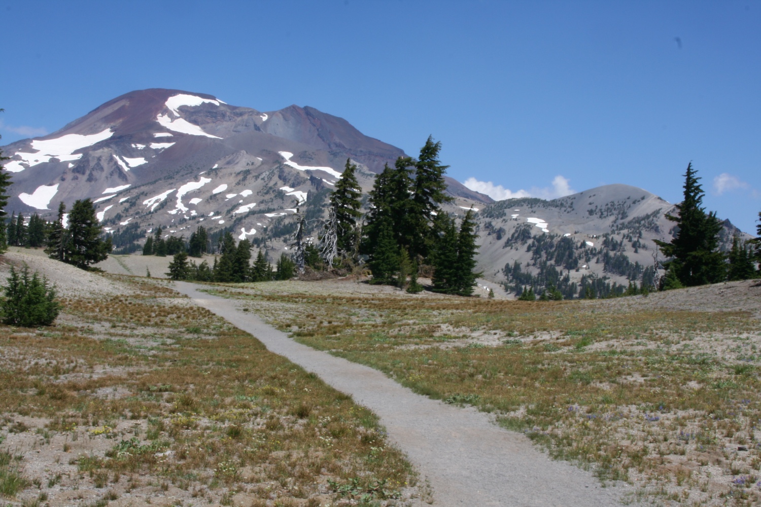
Trail across the ash plateau. Devil's Hill in the distance. |
|
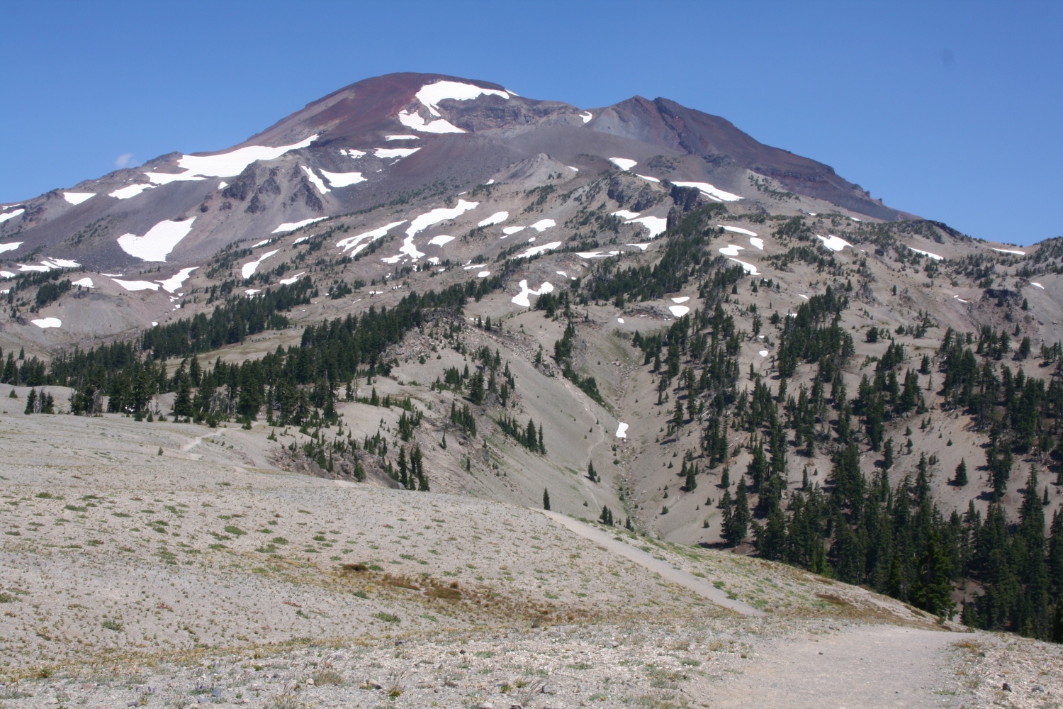
Looking back at South Sister. |
|
Broken top again, with lava flow visible in middle distance at right. |

|
Hikers on the shore of Moraine Lake |
|
Moraine lake |
|
South sister from a trail intersection. |
|
Another buckwheat. |
|
The long trail to South Sister. |
Finally we entered a true forest in the shadow of Devil's Hill. Here we met a fire crew, and followed them down to the trailhead. (Actually they let us pass at first, but soon caught up to us, so we let them lead from then on.) A woman at the end had come kind of net tossed over her shoulder, with a heavy metal hook that clanked as she walked. In the front, a man was improvising drumbeats on a cardboard box (I think it had contained drinking water in a plastic bag). It felt like a parade, and I silently thought the lyrics (the ones I could remember, anyway) to "Johnny comes marching home".
|
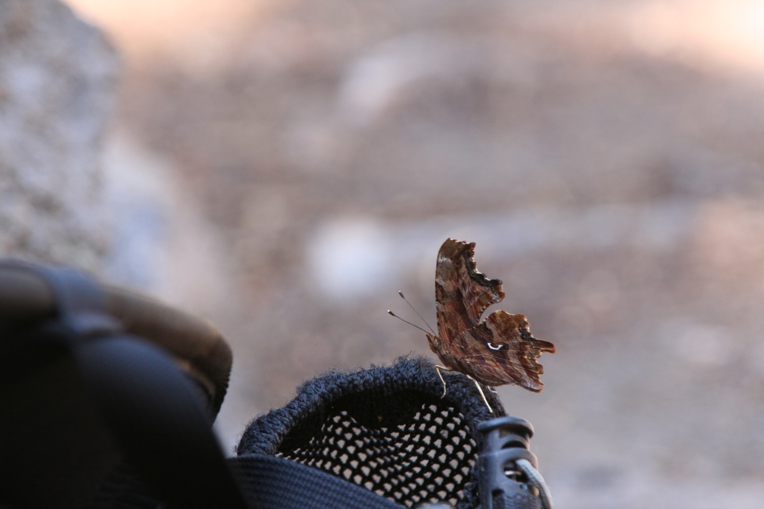
Back at camp: a butterfly (Polygonia sp.) on my backpack. |
|
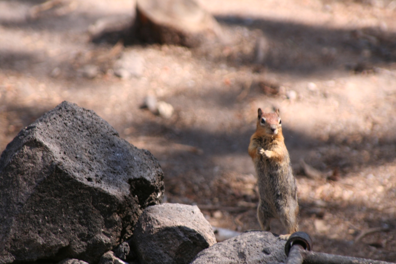
Another visitor in camp: a golden-mantled ground squirrel. |
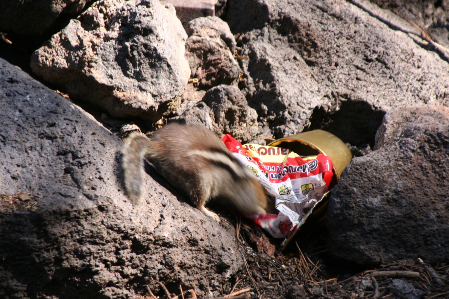
|
His visit was somewhat self-interested. |

|
Mimulus by the campsite. |