Caps Ridge view

|
Blowdown at the first viewing ledge. |

|
View toward the southern Presidentials at the second ledge. |

|
Looking ahead to Caps Ridge and low clouds. |

|
From a bit higher up, a view north past Castellated Ridge. |

|
The clouds are lifting and I get views of the foliage below. |

|
Ice on a cairn. Mt Eisenhower in the distance. |

|
One of the Caps that the trail climbs. |

|
A view toward rime-covered Mt Washington (actually this may be Clay - Washington's summit isn't visible from here). |

|
Ice on a clump of sedge. |

|
Closer shot of the ice. |

|
Closer still on the feathery rime. |
|
|
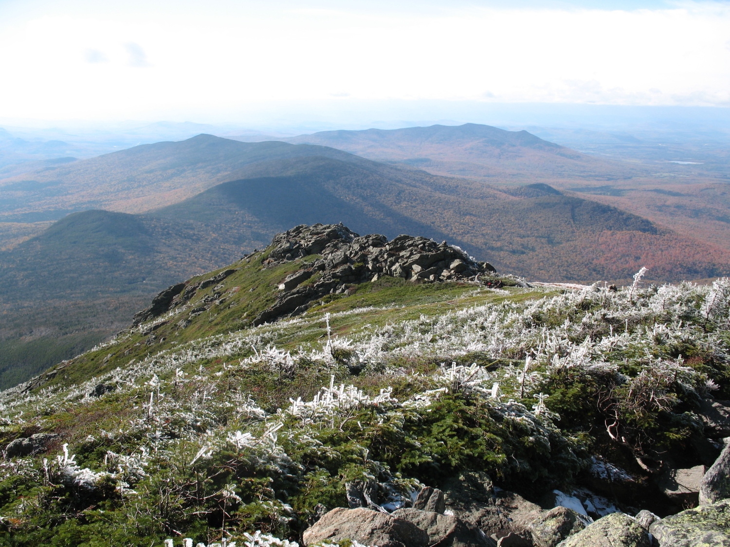
View back down the ridge. |

|
View toward Washington - Great Gulf headwall barely visible. |

|
View ahead - unfortunately that's not the summit. |

|
But I am gaining altitude, judging by how much more of Mt Washington I can see. |

|
Different framing of the view to Mt Washington. |

|
Another view down the ridge. |

|
The rime is getting really thick up here. |

|
View toward Mt Monroe, with passing clouds. |

|
This is the summit! |

|
View toward Nelson Crag. |

|
Carter Dome on the other side of Pinkham Notch. |

|
Rime-covered trail sign. |

|
A second later, the clouds part, revealing part of Mt Adams. |

|
There's the rest of Mt Adams. |

|
Clouds have returned a minute later - this giant cairn is near the summit. |

|
A view to Mt Adams. |

|
Another view of Mt Adams. |

|
Same giant cairn as before, suddenly in sunlight. |

|
Another view to Nelson Crag. |

|
One more shot of Mt Adams. |

|
Finally a clear view southward: Mt Clay, with the southern Presidentials in the distance. You can see the Gulfside Trail, passing to the right of Mt Clay. |

|
Snow flurries lit by sunbeams during my descent. |

|
A view down the ridge. |

|
Taking in the views of fall foliage as the light fades. |

|
Increasing snowfall and a view to the Castellated Ridge. |

|
A hint of sunset orange from the viewing ledge. |

|
Looking back up at Caps Ridge as the snow falls. |